The Albertine Rift Biodiversity
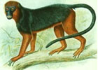
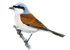
The Albertine Rift region is one of the most bio-diverse regions of the African continent. The region hosts 40% of Africa’s mammals, 50% of birds and about 20% of its amphibians and plants. It contains more vertebrate species than anywhere else on the continent. It also contains more threatened and endemic species than any other region of Africa; 41 bird species were identified solely in this region. As a result, the Albertine rift was classified as Biodiversity Hotspot by Conservation International, Eco-region by WWF and an Endemic Bird Area by Birdlife International. The diversity of biological life shows the habitat variety in the region including savannahs, lakes, montane forests and wetlands.
The Albertine Rift region is heavily threatened as a result of poverty and human demography leading to deforestation and a growing population seeks new farmland and animal poaching. There is also the challenge of policy and law implementation, especially on oil and mining in the protected areas and unharnessed peat scooping in wetlands. The region is also running the risk of disharmonized development projects on-going which can lead to environmental disasters despite being presented as the icons of economic growth.
In response to this in 2007, a number of partners in biodiversity conservation have established the Albertine Rift biodiversity monitoring framework to harmonize all biodiversity monitoring efforts in the region. The Albertine Rift Biodiversity portal has been developed to support the implementation of this framework by allowing biodiversity data holders in the region to share their data and exchange information on biodiversity and to allow policy makers to get the real picture of the achievements made in biodiversity conservation and spot gaps thus deriving better policies to protect this important resource.
This platform will provide tools to explore biodiversity data that has been published by ARCOS and its partners on the Albertine Rift, publications related to the biodiversity of the region as a well as a an interactive map that has tools to allows users visualize the extent at which biodiversity can be affected by the many development projects going on in the region.

Turaco

Chameleon

Frogs